
Search Cedar Hill Streets by Address
A Cedar Hill street search begins by deciding which county holds the parcel. Most of Cedar Hill is in Dallas County, but a small southern portion is in Ellis County. A postal city name does not settle that question. For a Dallas parcel, the appraisal record and the Dallas County Clerk index create the main address trail. For an Ellis parcel, use the Ellis map, ECAD routes, and the Ellis County Clerk. The difference matters before a name, deed, or permit is treated as evidence for a Cedar Hill address.
- Enter the street number and street name in the appropriate appraisal search. For Dallas parcels, the Dallas Central Appraisal District, or DCAD, requires a numeric address number and a street name of at least two characters; omit the street type from that field.
- Open the parcel card and retain the account number, situs address, current owner field, legal description, and transfer-date clues. These fields identify the parcel, but they do not prove a full household.
- Use the map route to see nearby parcels and confirm the street segment. Dallas County directs parcel data to DCAD, while Ellis County has its own geographic information system, or GIS, portal and appraisal routes.
- Search the county clerk record index with the owner, legal description, subdivision, or recorded-document details. A deed records a transaction trail, not a roster of current residents.
- For a past household clue, test local library materials, Dallas-area directories, and the Cedar Hill Chronicle. A verified Cedar Hill-specific reverse directory was not located, so do not assume an address-to-occupant volume exists.
That sequence keeps the evidence in order: parcel first, land record second, and household material last. It also avoids confusing a tax mailing address with where someone actually lives. Note: Keep the county, account number, legal description, and document date together so later searches can be checked against the same Cedar Hill parcel.
Cedar Hill Street Directory Search Fields
For Dallas County addresses, DCAD eSearch offers the entry points most useful for a Cedar Hill address search: street address, account, owner, business, and map. The street form supports a single number or a range. Its instructions matter. Street type is left out of the street-name field, percent signs work as wildcards, and a one-letter street name needs a wildcard. The city selector is available, but it does not replace the county check for a Cedar Hill address.
| DCAD field | Input | Required | How it helps by street |
|---|---|---|---|
| Address Number | Numeric | Yes | Starts a single-property or number-range search. |
| Direction | Selector | No | Separates directional versions of a Cedar Hill street. |
| Street Name | Text | Yes | Two-character minimum, no spaces, omit street type; % is a wildcard. |
| Building / Suite | Text | No | Adds a unit identifier when the address has one. |
| City | Selector | No | Helps narrow results but does not establish county jurisdiction. |
| From / To | Numeric pair | No | Browses a street-number range. |
| Account Type | Selector | No | Residential, commercial, or BPP, meaning business personal property, choices. |
The DCAD eSearch entry screen shows the address, account, owner, business, and map routes used for a Cedar Hill street-directory search.
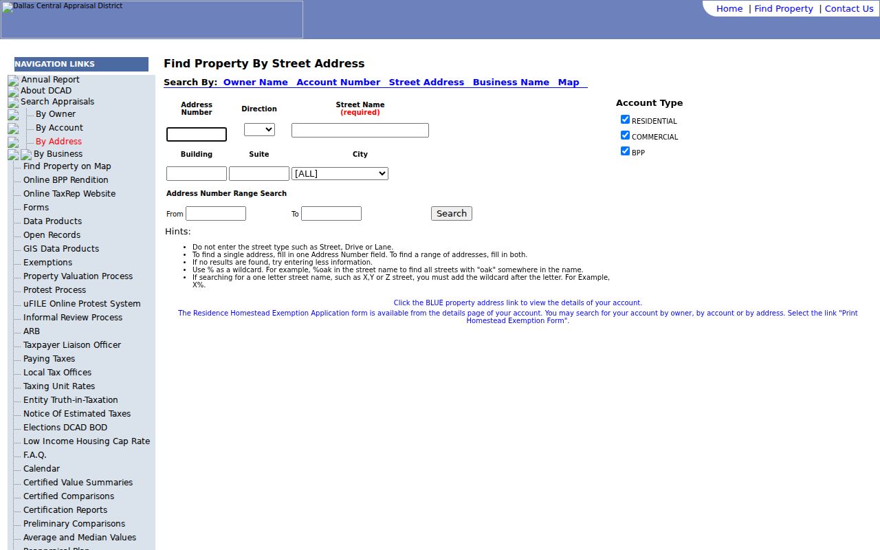
Use the selected parcel card to record the evidence fields, then switch to the clerk index for recorded-title questions. DCAD itself says its history is not a legal title document.
Cedar Hill Addresses Have Different Fields
The parcel card separates a situs address from an owner mailing address. Situs means the physical location assigned to the parcel. A mailing field tells DCAD where tax correspondence goes. Neither field proves that every named person lives there. The legal description is another identifier, often a subdivision plus lot and block or a metes-and-bounds description. It is especially useful when an older deed uses a description that does not resemble the modern Cedar Hill street address.
- Parcel
- A defined piece of land tracked by an appraisal account and map boundary.
- Situs address
- The location assigned to the parcel. It is different from the owner’s mailing address.
- Plat
- A recorded map that lays out lots, blocks, streets, or a subdivision. Its references help link a deed to land.
- Criss-cross directory
- An address-to-name directory, unlike a standard directory that usually begins with a name. No Cedar Hill-specific run was verified in the research.
DCAD can also display ownership percentages, transfer information, values, exemptions, improvements, and account history. Those features help distinguish parcels with similar addresses. They should not be used to infer family relationships or continuous occupancy. Note: A homestead entry is an appraisal-related claim, not conclusive evidence that a particular person currently occupies the Cedar Hill property.
Map Cedar Hill Street Parcels
Maps supply the street-level view that a name field cannot. Dallas County GIS states that parcel data is maintained at DCAD, so the DCAD map is the practical parcel viewer for a Dallas-side Cedar Hill street. Zoom to the area, select the parcel, and compare the card’s location and legal description with the parcels that share the street. The map supports orientation and parcel selection, rather than a list of people.
The Dallas County GIS page explains the county’s parcel-data route and offers its map and contact context.
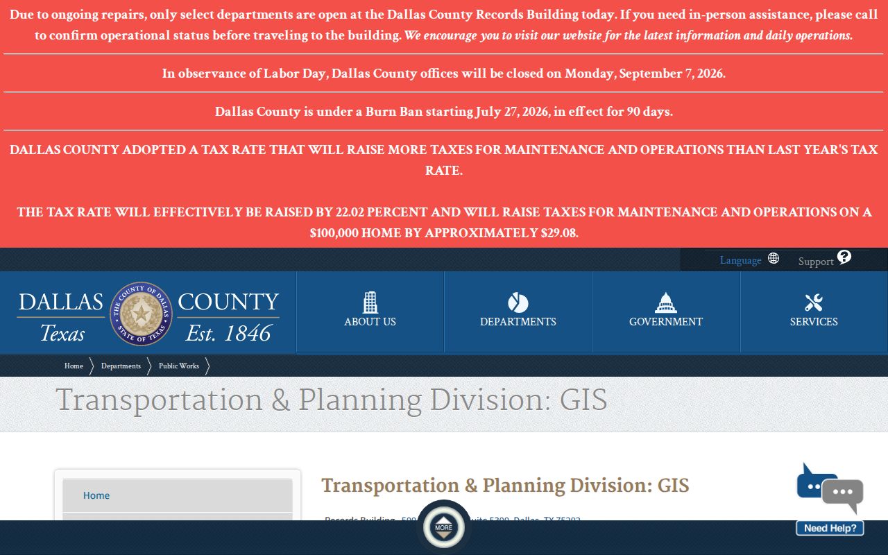
On the Ellis side of Cedar Hill, use the Ellis GIS and addressing route, turn on the address, road, and parcel layers, and then cross-check ECAD ownership data. The research did not verify an exact live ECAD field form, so a result layout or search capability should not be assumed.
Cedar Hill Address Record Coverage
Different address-keyed records answer different questions. The appraisal roll identifies a parcel and public ownership fields. A clerk index carries recorded transactions and legal-description references. City permit material can date work at an address. Historical material can suggest a household at a point in time. A Cedar Hill address search is strongest when the source type is stated beside the result rather than blended into a single claim about a person.
| Address record | Custodian | Street-level evidence | Access path |
|---|---|---|---|
| Appraisal card | DCAD or ECAD | Account, situs, owner and mailing fields, legal description, value, and history. | DCAD public search; ECAD site, map, and data routes. |
| Parcel map | DCAD map or Ellis GIS | Parcel boundaries, roads, address context, and adjacent polygons. | Public map tools; map data is geographic context. |
| Recorded instruments | Dallas or Ellis County Clerk | Grantor, grantee, dates, legal description, plats, liens, and instrument references. | Dallas portal, counter, and records center; Ellis LGS links or clerk counter. |
| Permit and planning material | Cedar Hill Building Inspections | Address, project, applicant or contractor, inspection, and status clues. | EnerGov account workflow or a focused Texas Public Information Act request. |
| Historical directories and papers | Library, TSLAC, UNT | Period name, address, occupation, notices, or obituary clues. | Library access, TSLAC holdings, and digitized newspaper search. |
The Texas SOS individual status service is not a street browser. Some voter information is public in defined contexts, while phone numbers, Social Security numbers, driver-license or state-ID information, and protected addresses have limits. A complete voter file follows separate county or state procedures and should not be treated as an open street roster.
Trace Cedar Hill Streets Through Deeds
For a Dallas County parcel, Dallas Official Records Quick Search accepts a search term and a recorded-date range, with quick date ranges and a department selector. The advanced form adds party-role fields, document type, instrument dates, document number, book, volume, page, lot, block, town, and legal-description fields. Begin with the address, subdivision, or legal description when it is distinctive. Then search the current owner as grantee and the seller as a prior grantee to work backward.
Dallas Official Records Quick Search is the public portal for the department, term, and date controls used before an advanced deed search.
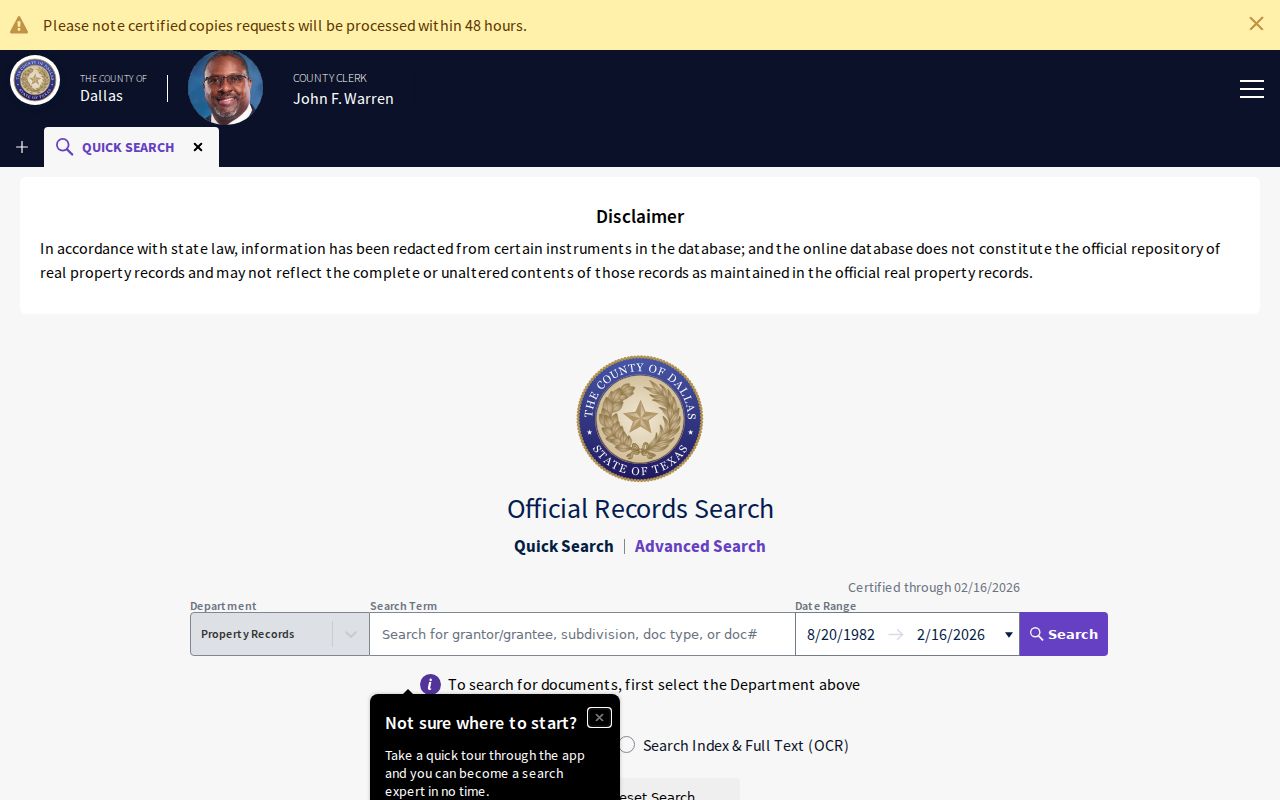
Dallas County materials describe records reaching back to 1846, but current image availability and indexing are not uniform. Central Records, microfilm, and the clerk counter are the fallback when a needed image is absent or restricted. That trail is addressed more deeply for one property on the Cedar Hill previous residents page.
Cedar Hill Streets Cross County Systems
Cedar Hill’s southern Ellis County portion has a separate property route. The Ellis County Online Record Search links its property and county-court LGS systems, and the clerk in Waxahachie holds the county’s property records. A cached county description reported guest index access and a registered account for image purchase, but the live field list, result limits, image pricing, and exact online cutoff were not available during the research. Describe a street, date range, record type, and legal description at the counter when online results stop.
Dallas County is handled in Dallas, while Ellis County records are handled in Waxahachie. Do not choose an office solely because a Cedar Hill mailing address appears in a search result. The parcel or event county controls the record route. This is also why Dallas County’s collection of Cedar Hill property taxes for both counties does not decide appraisal jurisdiction.
Cedar Hill Permit Address Clues
Cedar Hill’s permit process uses Tyler EnerGov for registered users to apply for permits, upload plans, check status, pay fees, schedule inspections, view inspection results, and work with planning cases. The portal launched in September 2018. Permit records may identify an applicant, contractor, owner, or agent, along with a project and dates. They do not prove that a named person occupied the address.
A general public code-case search was not found in the official sources. For an existing older permit, planning record, or code file that is not exposed, submit a narrow written request under the Cedar Hill open-records procedure. Give the address, record type, date range, and case or permit number when known. The Texas Public Information Act provides a route to existing non-exempt records; it does not require the city to create a street-by-street resident list.
Historic Cedar Hill Street Clues
Older Cedar Hill descriptions can use the town square, railroad, rural routes, or a legal description instead of a present-day street number. Local history places an 1871 town-square plat with J. M. Williams of the Santa Fe Railroad and records an 1856 tornado that destroyed much of the town. The 1881 railroad arrival and later city growth changed the physical context around old descriptions. Keep the historic wording as written, then compare it with the plat, deed description, and present parcel map.
The Cedar Hill Museum history also notes a 1892 directory snapshot with occupation counts, although an individual scan and named entries were not located. That makes it a search prompt, not proof that a particular name lived at a Cedar Hill address. Dallas County’s long records custody can provide an earlier land trail, while local newspapers and library resources add later context.
Cedar Hill Street Directory Limits
A parcel card does not list every person in a home. Utility customer lists and DMV address data are not public sources for this purpose. The voter status form is for an individual, and protected-address programs can limit what appears publicly. A mailing address can be a useful lead, but it must be labeled as mailing, not residence. Records can also be delayed, redacted, incomplete, or assigned to the other county.
Lawful use. Use Cedar Hill address records for personal, lawful research such as family history, property history, or civic questions. Do not use a street-directory result to stalk, harass, intimidate, or harm anyone.
For a historical occupant rather than a current parcel question, the Cedar Hill city directory collections provide the separate library and newspaper trail. Note: Confirm an important address fact with the official custodian and retain the record date, county, and source type with your notes.